Sometimes your GIS project needs some extra oomph. Maybe finding the data you need to understand deforestation in Brazil is giving you a headache. Or, you need to run a machine learning algorithm on 50 gigabytes of weather station data and your poor laptop is melting the finish off of your dining room table. Google Earth Engine (GEE) is here to help.
From the website, GEE’s purpose is to:
- Provide an interactive platform for geospatial algorithm development at scale
- Enable high-impact, data-driven science
- Make substantive progress on global challenges that involve large geospatial datasets
GEE is designed to make large-scale GIS projects feasible, but is also suitable for smaller projects. My main use-case is to pull environmental data from their petabyte scale database to model the potential distribution of species through time, e.g. this set of maps projecting the distribution of a species of Peruvian poison dart frog as it’s changed since the mid-Pleistocene.
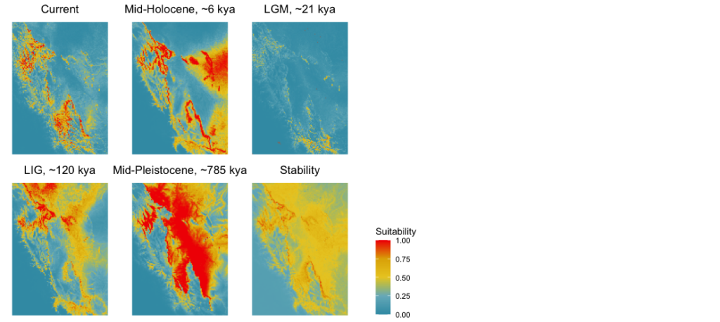
The first five panels show models of a frog species’ potential range from the present-day back to the mid-Pleistocene. The sixth panel shows areas of stability in the frog’s range over this time period. These models were constructed using publicly available environmental data related to the frog’s ecological tolerances.
Large amounts of data can be pulled down with a single line of code! An “Earth Engine Snippet” is provided for each dataset that you can copy into your GEE code editor.
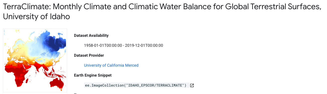
Example dataset highlighting the type of data available on Google Earth Engine and the ease of acquiring it through the Earth Engine Snippet.
In addition to acquiring data, a myriad of data processing and analytical tools are available. From cropping an image to machine learning, these tasks are performed on the Google Cloud platform, saving your computer from unnecessary RAM overload. There is a bit of a learning curve to using these tools, especially for those unfamiliar with coding. Thankfully, learning resources are plentiful. And for those with a preferred coding language, GEE code has been translated to JavaScript (the native language), python, and R! My preferred language is R, and there are a ton of examples to base your own ideas off of. For your next big GIS project, I recommend giving Google Earth Engine a shot!
Should you need help with your GIS project, we have some great resources through the GC Digital Fellows. For coding help and camaraderie, check out the Python User Group (PUG) and the R User Group (RUG). To hang out with folks interested in everything GIS, check out the GIS Working Group!

This entry is licensed under a Creative Commons Attribution-NonCommercial-ShareAlike 4.0 International license.